SWITZERLAND
THUR, SITTER
|
|
ALL ABOUT SWITZERLAND |
|
RIVERS RHINE THUR, SITTER |
||||
|
Swiss Rivers & Lakes River Rhine · River Thur · River Sitter · River Murg · River Töss · River Glatt · River Birs River Aare River Rhône River Reuss River Ticino River Linth/Limmat Swiss Tour |
River Rhine
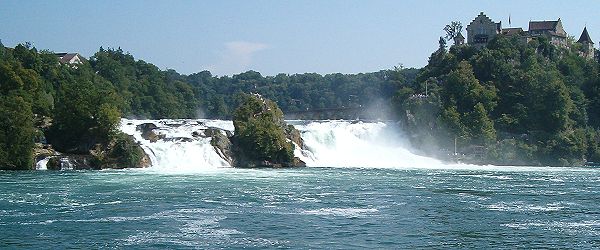
River Rhine [Rhein] is Switzerland's greatest river. It has its origin in
canton
Graubünden [Grisons, southeastern Switzerland]. River Rhine marks - roughly speaking, with some exceptions - Switzerland's border in the northeast and north of the country. The major exceptions are canton Schaffhausen, which is located on the north shore of River Rhine, and the cities of Basel (Switzerland) and Konstanz (Germany), which are bridgeheads. |
Orange: drainage area of Rivers Rhine, Thur, Sitter, Töss, Glatt and Birs
red: drainage area of Rivers Aare, Reuss and Limmat joining River Rhine
Vorderrhein originates east of Oberalp pass in a couple of small brooks. From there down to Ilanz, many brooks from side valleys multiply the amount of water carried away by the river. Most of the side valleys are uninhabitated, several of them are inundated by storage lakes feeding hydroelectrical power plants.
Well known resorts Sedrun, Disentis/Muster and Flims/Laax are located in Vorderrhein valley. Vals in a side valley is but one example of an old colony of German speaking people within the Rumantsch language area. They came from canton Wallis around 1200 and settled in side valleys so far not used by the native population, therefore they were named the Walser people. The village features a thermal spa and a mineral water spring.
Near Ilanz/Glion rocks and gravel deposited by a huge prehistoric landslide block the valley that would otherwise already be quite broad. The river has carved a narrow, but deep passage into this material during a few ten thousand years since. The region provides opportunities for scenic wild water river rafting. The usual risk of this sport is aggravated by the possibility of sudden water level rise due to local thunderstorms upstream and by operation of power plants.
Switzerland's alpine hydroelectrical power plants are operated to satisfy short term peak consumption not only in the country but in considerable parts of western Europe. If a single turbine block is set to operation, water level a few kilometers downstream may rise up to two meters (7 ft) within a few minutes. Only qualified tour operators have the knowledge and contacts to power plant operator to make sure they will not be surprised by unexpected rise of water level.
Hinterrhein originates behind the next mountain chain towards the south. A13 two-lane motorway/expressway, also known as the San Bernardino route runs through the valley. The route is a major alpine crossing and serves as an alternative in case the A2 St. Gotthard route is blocked. Hinterrhein valley is a narrow canyon, the traditional road there got the name via mala [bad road] because of the difficult terrain. While there is a San Bernadino road tunnel allowing all year passage to southern Switzerland, the Splügen pass road leading to Italy is closed in winter.
Avers side valley is another Walser colony, which was only accessible via a footh path over the mountains in the south for centuries. Today a couple of long bridges and tunnel allow all-year access from Hinterrhein valley. Juf at the upper end of Avers valley is known to be the highest village in Europe with a population staying there all-year.
From the point the two arms of River Rhine unite, the terrain is getting flatter and the river loses its wild water character. The first major city at the shores of River Rhine is Chur, capital of canton Graubünden and one of Switzerland's oldest cities. Further down is Landquart town, where river coming from Klosters joins in.
At Sargans the Rhine has definitely become a relatively broad and lazy river.
The section to Bodensee [Lake Constance] is called St. Galler Rheintal. River Rhine marks the border to the Principality of Liechtenstein, a tiny fully autonomous nation (25,000 inhabitants) with close relations to both Switzerland (customs and currency union) and Austria. Just before reaching Bodensee, River Rhine is the border between Switzerland and Austria.
At Bodensee [Lake Constance], the only lake River Rhine flows through, the general direction turns from South - North to East - West. Both the lake and the river section from there down to Basel are natural borders towards Germany, with a few exceptions, however. The city of Constance in the middle of the two parts of Bodensee is a German bridgehead, while Swiss cantons Schaffhausen and Basel-Stadt extend to the right shore.
On the final section of River Rhine as a border between Germany and Switzerland, there are no major towns on this Swiss side. Half way down to Basel, River Aaare joins River Rhine.
Originating in the prealpine Toggenburg valley at the southern side of Alpstein massif, River Thur is forced to turn eastwards at the city of Wil before making its way to the flat and broad Thurtal [Thur valley], the major part of canton Thurgau deriving its name from the river. Taking into account some danger of inundations, quite massive dams have been constructed in the valley and large areas are kept free of buildings. This provides a habitat for animals like the beaver.
A smaller prealpine river coming from the north side of Alpstein massif (canton Appenzell). A few kilometers west of St. Gallen, there is a famous railway bridge crossing Sittertobel [Sitter canyon] with a height of more than 100 m [300 ft]. R. Sitter joins R. Thur near the medieval town of Bischofszell.
Originating in the hills of Hinterthurgau, this small river runs through the city of Frauenfeld (capital of canton Thurgau) and joins R. Thur north of the city. The medieval nucleus of Frauenfeld with the castle is built on a plateau high above River Murg.
Tösstal [Töss valley], the rural eastern periphery of canton Zurich is Switzerland's "Bible Belt" with a significantly higher proportion of confessing conservative christians (evangelicals) than in other parts of the country. In a liberal European context, this minority (about 5% of the population in this region, compared to only 1% nationwide) gets some attention, but is has no significant political influence.
Glatttal is a major part of Zurich's metropolitan area with some important industrial cities (Uster, Dübendorf, Wallisellen) and Zurich's interational airport Kloten.
River Birs is the main river on the northwestern side of the Jura mountain chains. Regional centers of the Birs valley are Deémont (capital of canton Jura) for the French speaking upper part and Laufen for the German speaking lower part. At Birsfelden, a suburb of Basel, River Birs joins River Rhine.

Short quotations allowed but with precise declaration of origin (Link).
Reproduction of substantial parts and pictures in printed or electronic form
only with explicit written consent by the editor.
| Disclaimer | Privacy Policy | www.all-about-switzerland.info © 2005-2010 All Rights Reserved | Editor | ||